Eat and drink your way around the world on the Chicago Riverwalk this summer!

Eat and drink your way around the world on the Chicago Riverwalk this summer! Every Thursday from July 13 to August 17, Riverwalk visitors are invited to enjoy the food, drink, and music of Chicago’s 28 sister cities through Unifest. Presented by Chicago Sister Cities International, the festival will transform The Jetty on the Chicago Riverwalk (between Wells and Franklin) into a celebration of Chicago and international culture from 4:30 p.m. to 8:30 p.m.

The series kicks off this Thursday with live music from DJ Sadie Woods & DJ Madrid representing Paris, France, and a variety of spirits from China, Poland, Israel, and South Africa will be available. Baklava, from Athens, Greece and Fischbrötchen, a poached shrimp sandwich, from Hamburg, Germany will also be available for $4.

Lakefront Trail To Be Split Into Two Lanes From Ardmore To Montrose

The city is holding an open house next week to present its plans for separating the Lakefront Trail’s two northernmost miles into two distinct lanes: one for cyclists and one for runners.

The span of the trail between Ardmore and Montrose avenues is set to be split into a 12-foot-wide asphalt bike trail, which will be closest to Lake Shore Drive, and a 20 foot wide pedestrian path with 14 feet of asphalt and 6 feet of soft surface mix on either side.

Mayor Rahm Emanuel announced plans last year to separate paths for runners and bicyclists along 7 miles of the busy Lakefront Trail between Fullerton Avenue and Ohio Street and from 31st to 51st streets.

In December, the city received a $12 million gift from Ken Griffin, a donor of Emanuel’s and the richest man in Illinois, which allowed the Chicago Park District to add the remaining 11 miles of the trail to its plans for redevelopment.

Residents will get a chance to see how the northern lakefront path will be separated at an open house from 4-7 p.m. on Aug. 1 inside Uptown’s Margate Park Fieldhouse, 4921 N. Marine Drive.

Representatives from the park district, as well as the Chicago Area Runners Association and Active Transportation Alliance will present a draft of its plans, as well as gather feedback and answer questions.

Mayor Declares Western Viaduct Project Complete — Early And On Budget

The remaking of the Western-Belmont-Clybourn intersection began 16 months ago with the ear-splitting clang of hydraulic excavators and ended with the soundless snip of a pair of ceremonial scissors.

At a ribbon cutting Monday afternoon, Mayor Rahm Emanuel declared the construction project officially complete, a month early and on budget.

The project kicked off in March 2016 with the demolition of an aging and outdated viaduct at Western and Belmont, constructed in the 1960s to manage traffic flow around the now defunct Riverview Amusement Park.

“That bridge was an eyesore,” Emanuel said.

Aesthetics aside, the overpass no longer met engineering standards and had been deemed “structurally deficient.” Officials also argued that it provided a physical barrier to development, impeding the flow of retail shops and restaurants.

A five-leg grade-level intersection at Western, Belmont and Clybourn replaced the viaduct.

The intersection now has three lanes of traffic in each direction during rush hours, with curbside parking in some areas during off-peak hours, according to the Chicago Department of Transportation.

Traffic signals have been programmed for the new configuration and have the capacity to provide “Transit Signal Priority” for CTA buses, speeding up bus service, officials said in a statement.

The scope of the project included numerous repairs and improvements, many of them aimed at increasing pedestrian safety, along a stretch of Western Avenue between Waveland Avenue and Logan Boulevard.

“Our hope is that it creates a safer environment and enhanced traffic flow while helping to improve the quality of life for the surrounding neighborhood,” said Rebekah Scheinfeld, CDOT commissioner.

The project cost $27.3 million and was funded through a combination of federal, state and Tax Increment Finance dollars, according to a statement from the Mayor’s Office.

Lake Shore Drive Ramps To Stevenson Expy. Are FINALLY Opening

Ramps from Lake Shore Drive to the outbound Stevenson Expressway will be open after construction wraps up Wednesday.

The ramps will open immediately after construction finishes. Drivers will be able to take the ramps from north- and southbound Lake Shore Drive to the outbound Stevenson Expressway.
The move is a “milestone,” according to an Illinois Department of Transportation news release. The $475 million Interchange Reconstruction Project has been going on since 2013.

There will be some closures while construction finishes Tuesday and Wednesday.

Lake Shore Drive Ramps To Stevenson Expy. Are FINALLY Opening – Downtown – DNAinfo Chicago

Here’s what to watch out for:

• The ramp going from southbound Lake Shore Drive to the outbound Stevenson will be closed midnight to 5 a.m. Tuesday.

• The ramp going from northbound Lake Shore Drive to the outbound Stevenson will be closed 1-5 a.m. Wednesday.

• There will be intermittent stops on the southbound Stevenson Expressway 3-4 a.m. Wednesday.

• There will be temporary lane closures during “off-peak travel” times on the Stevenson to finish up, IDOT said.

Drivers should plan for trips to take extra time during the closures and should watch for workers in the area.

Free ‘L’ And Uber Rides After Cubs, Sox Games For Crosstown Classic

The CTA is offering free rides after games during this week’s Crosstown Classic.

On Monday and Tuesday, when the Cubs and Sox face off at Wrigley Field, riders will be able to take the Red Line from the Addison stop for free up to three hours after the games, according to a CTA news release.

The No. 80 Irving Park and No. 152 Addison buses will also have extra service for two hours before the games and an hour after they end, the CTA said.

On Wednesday and Thursday, when the teams head to Guaranteed Rate Field, there will be free Red Line rides at Sox-35th stop for two hours after the games, the CTA said.

On those dates, there will be extra Red Line service and extra Yellow Line service from Howard until midnight, the CTA said.

The CTA is also advising those heading out for the games to buy unlimited-ride passes in advance and to plan for trips to take longer than usual. Passes can be bought online or at stations.

Uber will also allow users to get one free trip worth up to $10 from the ballpark or nearby spots. Users can enter the promo code MLCROSSTOWN 3-8 p.m. Monday and Tuesday or 9 p.m.-2 a.m. Wednesday and Thursday.

The rides are part of a partnership between Uber, the CTA, Miller Lite and Chicago Beverage Systems.

Here’s a schedule for the games:

• 1:20 p.m. Monday at Wrigley Field

• 1:20 p.m. Tuesday at Wrigley Field

• 7:10 p.m. Wednesday at Guaranteed Rate Field

• 7:10 p.m. Thursday at Guaranteed Rate Field

Slow Roll Chicago Coming To Beverly And The Afterparty Is Already Planned

A Slow Roll Chicago bicycle tour of Beverly and Morgan Park begins at 2 p.m. July 29 at the Ridge Historical Society and ends around 4 p.m. with an afterparty at Tranquility Hair Salon.

Anne Alt is coordinating the bike ride that begins at the historical society at 10621 S. Seeley Ave. in Beverly. An advocate for cycling in the 19th Ward, Alt said its only the second such ride ever planned for the neighborhoods.
She expects more than 50 people to participate in the all-ages ride that will send cyclists along tree-lined residential streets. Alt plans to make several stops along the way to highlight local architecture and public art.
The roughly 10-mile ride is also being planned with the help of the Beverly Area Arts Alliance, which also coordinates the annual Beverly Art Walk, the Uprising Craft Market and Local Art on Tap.
The whole event is meant to bring individuals together, said Alt, pointing to Slow Roll Chicago’s mission that aims to “connect a diverse group of people.”

In fact, Slow Roll Chicago was founded in September 2014 as an off-shoot of Slow Roll Detroit, which was launched four years earlier. The community bike rides in Detroit now average more than 4,000 riders every Monday night.

She also hopes people already biking in the neighborhood use the ride to get to know others with similar passions living nearby. Such relationships likely will be fostered at the afterparty hosted by the owners of the salon near the 99th Street Metra station.

Tranquility at 9908 S. Walden Parkway is planning a street festival for participants as they wrap up their ride. Megan Barba, an owner of the salon, said the free after-party will include music, craft beer, food trucks and other refreshments along with face-painting and more for children.

Those looking for a good stretch after the ride are also invited to a free yoga session courtesy of E’a Williams, an instructor who also works at the Old Town School of Folk Music in Lincoln Square. Those interested are asked to bring their own yoga mat.

The alliance is also using the afterparty to offer a sneak peek of the work 11 artists participating in the annual neighborhood art walk, which will again transform storefronts throughout the area into makeshift art galleries Oct. 7.

Kevin Demski will be among them. The artist behind Sixty Four Creative will be pulling limited-run prints on site for 3 hours at the post-ride party.

Once the bike riders thin out, Tranquility will use the evening to host the Beverly Music Initiative: Part III of the Backyard Project. The event from 7-10 p.m. will showcase the music of H.a.R.D.

A $25 suggested donation is asked of those interested in the neo-soul band with influences that include funk, heavy blues and hip hop, Barba said. Craft beer will also be provided as part of the entry free.

Previous efforts to transform the salon into a live music venue have showcased a Grateful Dead cover band and a folk duo from Nashville with credits that include opening for Loretta Lynn.

“It will be a great day to be down here,” said Barba, who aims to host more music-focused events going forward.

Bike-Friendly Plan for Milwaukee Ave. Nixes Car Turn Lanes, Some Parking

Right-turn lane closures, reducing parking spaces and eliminating bus stops while adding more pavement markings and space on the street for cyclists to gather at intersections are among several “pilot” changes coming to a 1.7-mile stretch of Milwaukee Avenue as soon as next month.

Officials say the changes are designed to make the Wicker Park and Bucktown thoroughfare safer for the thousands of cyclists, pedestrians and drivers who rely on the congested corridor.
At a public meeting on Wednesday, Mike Amsden, a Chicago Department of Transportation official, said the measures — part of the city’s “Complete Streets” initiative — would include reducing speed limits to 20 miles-per-hour from 25; removing two right-turn “slip lanes” used by car drivers at the southwest corner of the Milwaukee and Damen intersection and at Ashland and Milwaukee Avenue; eliminating 32 car parking spaces; and removing two bus stops.

LANE REMOVALS: The right “slip lane” removal at the Ashland and Milwaukee intersection would still enable cars to turn right on Milwaukee Avenue to head north but not trucks (the turn would be too tight), and the loss of the slip lane at Wicker Park’s main hub would prohibit all right turns by cars going south on Milwaukee Avenue, Amsden said.

Amsden said as many as 1,000 pedestrians cross the Damen and Milwaukee slip lane — separated from two other Damen traffic lanes by a triangular concrete island — during peak morning and evening hours, while city data collectors observed just 32 cars turning right at that spot during the same period.

Car drivers who need to go south on Milwaukee from northbound Damen could use alternative routes such as Wicker Park Avenue or Evergreen Street, Amsden suggested

extralarge

Estimated to cost $200,000, the “low-cost, quick-hitting pilot improvements” as the transportation department calls the measures, will also add new crosswalks, though those would not be installed until late fall, while all the other planned changes would kick off in August.

PARKING SPOTS: Amsden said there are approximately 375 existing parking spaces in the pilot focus area along Milwaukee Avenue between Division Street and Armitage Avenue. That means that the planned loss of 32 parking spaces would represent 8.5 percent of the existing parking spaces.
BICYCLES: The plans do not include the bike lanes that many activists had been hoping to see —  though, in front of a crowd of about 50 at the meeting in A.N. Pritzker School, 2009 W. Schiller St., Amsden said bike lanes could be under consideration in the next 10 years to coincide with larger and more costly street resurfacing and reconstruction projects.

The plans also include adding bright green pavement markings to aid left turns for cyclists trying to go west on the Bloomingdale Trail off of Milwaukee Avenue. Some one-quarter of cyclists headed north on Milwaukee Avenue try to make that left turn to get on the trail, Amsden said.

extralarge

A left turn lane for northbound Milwaukee cyclists onto the Bloomingdale Trail’s west ramp, plus painted pavement “bike boxes” at Milwaukee/Leavitt and larger curb “bump outs” for pedestrians are planned for the 1800 block of North Milwaukee Avenue. [DNAinfo/Alisa Hauser] 

The city also plans to combine two turn lanes into one on Wabansia Avenue going southbound toward Milwaukee Avenue in order to add room for a dedicated bike lane with paint markings on the side street.

Bike-Friendly Plan for Milwaukee Ave. Nixes Car Turn Lanes, Some Parking – Wicker Park – DNAinfo Chicago

• BUS STOPS: Removing stops is aimed at reducing the potential of collision with bicyclists at certain corners along the corridor. The plans eliminate a southbound Milwaukee No. 66 bus stop at Milwaukee and Damen Avenue and another southeast bound No. 66 stop at Milwaukee and Ashland at the Polish Triangle.
Also, a cab stand currently on Milwaukee Avenue could be relocated to Ashland Avenue, Amsden said.

After the meeting, Ken Lee, an architect from Independence Park, who said he has been commuting year round down Milwaukee Avenue by bike, praised the coming changes.

“For several years I’ve been waiting, thinking when will it really happen, when will Milwaukee Avenue get better? The budget is what it is. I’d rather see this than nothing at all. If you go with bollards and paint markings, it can be removed if it doesn’t work out. It’s a great idea to try smaller, less expensive things first,” Lee said. 

Jim Merrell, advocacy director for the Active Transportation Alliance, which formed an online petition to call for dedicated bike lanes on Milwaukee Avenue, described the proposed changes as “a really good first step” — and emphasized the group will “keep pushing” for bike lanes.

Amsden cautioned that the designs presented on Wednesday were “not totally finalized” but folks can expect the changes to be officially announced soon in press releases and notifications through aldermanic offices and the the Wicker Park Bucktown Taxpayer No. 33 District, a volunteer-led group which hired a team of consultants to craft a vision for the growing Wicker Park and Bucktown neighborhoods.

31st Street Bus Set To Run Until At Least March

The CTA has authorized an extension of the 31st Street bus pilot program through March.

The bus operates from the Ashland Orange Line station to 33rd Street and King Drive. It was shut down in 1997 due to low ridership but neighborhood advocates pushed for its reinstatement, and the CTA started a pilot program in September to see if it would attract enough ridership to be brought back permanently.

In March, the pilot program was extended for six more months.

During a monthly meeting Wednesday, the CTA board discussed possible ways to boost ridership on the line through more advertising with churches and a possible partnership with the White Sox.

The bus operates from 10 a.m.-7 p.m. weekdays with a target ridership of roughly 830 riders, according to the CTA. In the past, the limited service schedule has generated a lot of criticism from advocates for the bus.

Chicago Street Parking Is An Expensive, Time-Sucking Nightmare, Study Shows

Chicagoans pay an average of $13 for two hours of street parking, a new report has found — meaning the city has the most expensive street parking in the United States.

The city’s street parking is even more expensive than in car-crowded New York ($7) and Los Angeles ($8), according to a report from INRIX, a company that creates apps for parking and traffic. The report collected data from thousands of drivers and more than 100,000 parking locations.

Two-hour parking in a garage or in another area off the street is even more expensive at $21.54 in Chicago, but other cities have it worse: New Yorkers pay $32.80 while people in Boston dish out $25.59.

The report found Chicagoans spend an average of nine minutes per trip looking for street parking and eight minutes for off-street parking. The time, fuel and emissions wasted on that search add up to $1,174 per driver every year — or $1.3 billion per year for all of Chicago.

In comparison, New Yorkers spent 15 minutes looking for street parking and 13 minutes looking for off-street parking to the tune of $4.3 billion.

People in Los Angeles and San Francisco each spend 12 minutes looking for street parking and 11 for off-street parking, which ends up costing people in those cities $3.7 billion and $655 million, respectively.

More Bike Lanes Needed On Milwaukee Avenue In Wicker Park, Activists Say

The Chicago Department of Transportation will unveil proposed changes to make a 1½-mile stretch of Milwaukee Avenue safer this week, but activists said the changes don’t go far enough — they want bike lanes.

The city’s plan for a stretch of Milwaukee that includes Wicker Park’s busy six-way hub at Milwaukee, Damen and North avenues will be presented at a meeting set for 6-8 p.m. Wednesday in the auditorium of A.N. Pritzker School, 2009 W. Schiller St. The public gathering is a follow up to an earlier meeting in May and will feature a presentation, Q&A and open house.
But for several activists planning to attend on Wednesday, the “low-cost, quick-hitting pilot improvements” as the transportation department calls the measures on its website, are not enough. They want bike lanes.

More than 1,400 people have signed the Active Transportation Alliance’s online petition asking for bike lanes on Milwaukee Avenue between Division Street and Armitage Avenue — the focus area for the planned improvements.

“Knowing how many of our members and supporters desperately want to see bike lanes and safer crossings on Milwaukee Ave, our biggest goal is to get folks to attend and provide their input and feedback on the recommendations [the city] will be sharing,” said Jim Merrell, the alliance’s advocacy director.

Merrell said the advocacy group will be sharing its petition with city transportation officials and the three aldermen whose wards are in the focus area. Last month, about 60 people attended a rally for the bike lanes at Arc’Teryx.

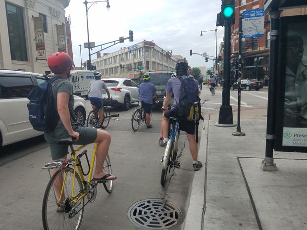
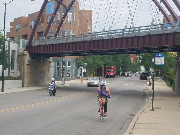
Milwaukee Avenue, a busy hub for cyclists that sees thousands of cyclists daily, is deemed a “spoke route” in the city’s “Streets for Cycling” plan to build a network of protected bike lanes.

Milwaukee Avenue now has white bike lane pavement markings between Division Street and Armitage Avenue, but no buffers or barriers between cyclists and cars; only a “sharrow” — or shared lane for bikes and cars — exists.

The lack of dedicated space for cyclists has resulted in what some have called “a dooring epidemic” on the stretch with crashes between bikes and cars happening on a frequent basis. The issue is also a problem citywide, which has seen a 50 percent jump in dooring crashes, according to recently released data.

“Our ultimate goal is for all of Milwaukee Avenue to be safe and comfortable for people on foot, bike or transit,” Merrell said.

Among the design improvements that transportation department official Mike Amsden said in May could be rolled out as soon as late summer are adding higher visibility crosswalks with new paint, putting posts or bollards on the road to create a separation between cars and bikes, and installing “bump outs” or extra curb space to reduce pedestrian crossing distances.

Removing the right turn or “slip lane” used by car drivers who head north on Damen Avenue to turn onto Milwaukee Avenue at the southwest corner of the intersection was also suggested at the meeting in May. The removal of the under-used car turn lane would allow more room for pedestrians.

The changes coming to Milwaukee Avenue were prompted in part by the recently updated Wicker Park Bucktown Master Plan, commissioned by the Wicker Park Bucktown Taxpayer No. 33 District, a volunteer-led group which hired a team of consultants to craft a vision for the growing Wicker Park and Bucktown neighborhoods.

“Re-envisioning the Milwaukee/North/Damen intersection to be balanced and safer for all users” was a key component of the plan.