Category Archives: Review

Uber And Lyft Giving Refunds For Surge Pricing During CTA Stoppage

Uber and Lyft have refunded people who had to pay costly surge prices when the Brown, Red and Purple lines were down earlier this week.

Uber said it gave refunds to people who “experienced higher-than-average prices in the affected” areas on Tuesday morning. The refund will cover what people paid versus the average cost of a trip on a weekday morning.

The train lines were down on the North Side for about three hours, leading to a high demand for Uber and Lyft rides. Those rides came with eye-popping prices, such as $110 to get from Lakeview to the Loop. That trip could cost as little as $13 without surge pricing.

“Every transportation provider — public and private — has a role to play in keeping our communities moving,” Uber said in an emailed statement on Thursday. “And due to the tragic incident Tuesday morning, our communities felt stranded.

“While we took steps to help mitigate the impact on commuters as soon as we learned of the CTA stoppage, we have issued refunds to riders who experienced higher-than-average prices in the affected areas.”

Lyft was up 5½ times its usual rate during the scramble. Uber rates were 3½ times the normal fare, according to a rider.

Uber said the refunds will not impact drivers who logged rides during the CTA stoppage.

Lincoln Common Preps To Install Construction Crane For South Tower

The cranes are coming to roost at the Lincoln Commonconstruction site at the former Children’s Memorial Hospital.

In its latest update on the project, which will bring 540 residential units to the site at 2300 N. Lincoln Ave., Lincoln Common said this week it would continue with excavation and earth retention, but it would also pour the foundation for the construction crane on the south tower.

The crane is scheduled to be installed next week, calling for Lincoln Avenue to be closed between Orchard Avenue and the entrance to the parking garage across the street Aug. 23-25. The sidewalk will also be closed on the east side of Lincoln Avenue, but will remain open on the west side.

The project includes two luxury-apartment towers as well as 60 low-rise condominiums. Developer Dan McCaffery said at the ceremonial groundbreaking in May that construction would take about two years to complete.

Construction crews will also erect a pedestrian canopy next week over the Fullerton Avenue sidewalk on the north side of the triangular Lincoln Common site.

Mayor Declares Western Viaduct Project Complete — Early And On Budget

The remaking of the Western-Belmont-Clybourn intersection began 16 months ago with the ear-splitting clang of hydraulic excavators and ended with the soundless snip of a pair of ceremonial scissors.

At a ribbon cutting Monday afternoon, Mayor Rahm Emanuel declared the construction project officially complete, a month early and on budget.

The project kicked off in March 2016 with the demolition of an aging and outdated viaduct at Western and Belmont, constructed in the 1960s to manage traffic flow around the now defunct Riverview Amusement Park.

“That bridge was an eyesore,” Emanuel said.

Aesthetics aside, the overpass no longer met engineering standards and had been deemed “structurally deficient.” Officials also argued that it provided a physical barrier to development, impeding the flow of retail shops and restaurants.

A five-leg grade-level intersection at Western, Belmont and Clybourn replaced the viaduct.

The intersection now has three lanes of traffic in each direction during rush hours, with curbside parking in some areas during off-peak hours, according to the Chicago Department of Transportation.

Traffic signals have been programmed for the new configuration and have the capacity to provide “Transit Signal Priority” for CTA buses, speeding up bus service, officials said in a statement.

The scope of the project included numerous repairs and improvements, many of them aimed at increasing pedestrian safety, along a stretch of Western Avenue between Waveland Avenue and Logan Boulevard.

“Our hope is that it creates a safer environment and enhanced traffic flow while helping to improve the quality of life for the surrounding neighborhood,” said Rebekah Scheinfeld, CDOT commissioner.

The project cost $27.3 million and was funded through a combination of federal, state and Tax Increment Finance dollars, according to a statement from the Mayor’s Office.

Lake Shore Drive Ramps To Stevenson Expy. Are FINALLY Opening

Ramps from Lake Shore Drive to the outbound Stevenson Expressway will be open after construction wraps up Wednesday.

The ramps will open immediately after construction finishes. Drivers will be able to take the ramps from north- and southbound Lake Shore Drive to the outbound Stevenson Expressway.
The move is a “milestone,” according to an Illinois Department of Transportation news release. The $475 million Interchange Reconstruction Project has been going on since 2013.

There will be some closures while construction finishes Tuesday and Wednesday.

Lake Shore Drive Ramps To Stevenson Expy. Are FINALLY Opening – Downtown – DNAinfo Chicago

Here’s what to watch out for:

• The ramp going from southbound Lake Shore Drive to the outbound Stevenson will be closed midnight to 5 a.m. Tuesday.

• The ramp going from northbound Lake Shore Drive to the outbound Stevenson will be closed 1-5 a.m. Wednesday.

• There will be intermittent stops on the southbound Stevenson Expressway 3-4 a.m. Wednesday.

• There will be temporary lane closures during “off-peak travel” times on the Stevenson to finish up, IDOT said.

Drivers should plan for trips to take extra time during the closures and should watch for workers in the area.

Bike-Friendly Plan for Milwaukee Ave. Nixes Car Turn Lanes, Some Parking

Right-turn lane closures, reducing parking spaces and eliminating bus stops while adding more pavement markings and space on the street for cyclists to gather at intersections are among several “pilot” changes coming to a 1.7-mile stretch of Milwaukee Avenue as soon as next month.

Officials say the changes are designed to make the Wicker Park and Bucktown thoroughfare safer for the thousands of cyclists, pedestrians and drivers who rely on the congested corridor.
At a public meeting on Wednesday, Mike Amsden, a Chicago Department of Transportation official, said the measures — part of the city’s “Complete Streets” initiative — would include reducing speed limits to 20 miles-per-hour from 25; removing two right-turn “slip lanes” used by car drivers at the southwest corner of the Milwaukee and Damen intersection and at Ashland and Milwaukee Avenue; eliminating 32 car parking spaces; and removing two bus stops.

LANE REMOVALS: The right “slip lane” removal at the Ashland and Milwaukee intersection would still enable cars to turn right on Milwaukee Avenue to head north but not trucks (the turn would be too tight), and the loss of the slip lane at Wicker Park’s main hub would prohibit all right turns by cars going south on Milwaukee Avenue, Amsden said.

Amsden said as many as 1,000 pedestrians cross the Damen and Milwaukee slip lane — separated from two other Damen traffic lanes by a triangular concrete island — during peak morning and evening hours, while city data collectors observed just 32 cars turning right at that spot during the same period.

Car drivers who need to go south on Milwaukee from northbound Damen could use alternative routes such as Wicker Park Avenue or Evergreen Street, Amsden suggested

extralarge

Estimated to cost $200,000, the “low-cost, quick-hitting pilot improvements” as the transportation department calls the measures, will also add new crosswalks, though those would not be installed until late fall, while all the other planned changes would kick off in August.

PARKING SPOTS: Amsden said there are approximately 375 existing parking spaces in the pilot focus area along Milwaukee Avenue between Division Street and Armitage Avenue. That means that the planned loss of 32 parking spaces would represent 8.5 percent of the existing parking spaces.
BICYCLES: The plans do not include the bike lanes that many activists had been hoping to see —  though, in front of a crowd of about 50 at the meeting in A.N. Pritzker School, 2009 W. Schiller St., Amsden said bike lanes could be under consideration in the next 10 years to coincide with larger and more costly street resurfacing and reconstruction projects.

The plans also include adding bright green pavement markings to aid left turns for cyclists trying to go west on the Bloomingdale Trail off of Milwaukee Avenue. Some one-quarter of cyclists headed north on Milwaukee Avenue try to make that left turn to get on the trail, Amsden said.

extralarge

A left turn lane for northbound Milwaukee cyclists onto the Bloomingdale Trail’s west ramp, plus painted pavement “bike boxes” at Milwaukee/Leavitt and larger curb “bump outs” for pedestrians are planned for the 1800 block of North Milwaukee Avenue. [DNAinfo/Alisa Hauser] 

The city also plans to combine two turn lanes into one on Wabansia Avenue going southbound toward Milwaukee Avenue in order to add room for a dedicated bike lane with paint markings on the side street.

Bike-Friendly Plan for Milwaukee Ave. Nixes Car Turn Lanes, Some Parking – Wicker Park – DNAinfo Chicago

• BUS STOPS: Removing stops is aimed at reducing the potential of collision with bicyclists at certain corners along the corridor. The plans eliminate a southbound Milwaukee No. 66 bus stop at Milwaukee and Damen Avenue and another southeast bound No. 66 stop at Milwaukee and Ashland at the Polish Triangle.
Also, a cab stand currently on Milwaukee Avenue could be relocated to Ashland Avenue, Amsden said.

After the meeting, Ken Lee, an architect from Independence Park, who said he has been commuting year round down Milwaukee Avenue by bike, praised the coming changes.

“For several years I’ve been waiting, thinking when will it really happen, when will Milwaukee Avenue get better? The budget is what it is. I’d rather see this than nothing at all. If you go with bollards and paint markings, it can be removed if it doesn’t work out. It’s a great idea to try smaller, less expensive things first,” Lee said. 

Jim Merrell, advocacy director for the Active Transportation Alliance, which formed an online petition to call for dedicated bike lanes on Milwaukee Avenue, described the proposed changes as “a really good first step” — and emphasized the group will “keep pushing” for bike lanes.

Amsden cautioned that the designs presented on Wednesday were “not totally finalized” but folks can expect the changes to be officially announced soon in press releases and notifications through aldermanic offices and the the Wicker Park Bucktown Taxpayer No. 33 District, a volunteer-led group which hired a team of consultants to craft a vision for the growing Wicker Park and Bucktown neighborhoods.

31st Street Bus Set To Run Until At Least March

The CTA has authorized an extension of the 31st Street bus pilot program through March.

The bus operates from the Ashland Orange Line station to 33rd Street and King Drive. It was shut down in 1997 due to low ridership but neighborhood advocates pushed for its reinstatement, and the CTA started a pilot program in September to see if it would attract enough ridership to be brought back permanently.

In March, the pilot program was extended for six more months.

During a monthly meeting Wednesday, the CTA board discussed possible ways to boost ridership on the line through more advertising with churches and a possible partnership with the White Sox.

The bus operates from 10 a.m.-7 p.m. weekdays with a target ridership of roughly 830 riders, according to the CTA. In the past, the limited service schedule has generated a lot of criticism from advocates for the bus.

Chicago Street Parking Is An Expensive, Time-Sucking Nightmare, Study Shows

Chicagoans pay an average of $13 for two hours of street parking, a new report has found — meaning the city has the most expensive street parking in the United States.

The city’s street parking is even more expensive than in car-crowded New York ($7) and Los Angeles ($8), according to a report from INRIX, a company that creates apps for parking and traffic. The report collected data from thousands of drivers and more than 100,000 parking locations.

Two-hour parking in a garage or in another area off the street is even more expensive at $21.54 in Chicago, but other cities have it worse: New Yorkers pay $32.80 while people in Boston dish out $25.59.

The report found Chicagoans spend an average of nine minutes per trip looking for street parking and eight minutes for off-street parking. The time, fuel and emissions wasted on that search add up to $1,174 per driver every year — or $1.3 billion per year for all of Chicago.

In comparison, New Yorkers spent 15 minutes looking for street parking and 13 minutes looking for off-street parking to the tune of $4.3 billion.

People in Los Angeles and San Francisco each spend 12 minutes looking for street parking and 11 for off-street parking, which ends up costing people in those cities $3.7 billion and $655 million, respectively.

More Bike Lanes Needed On Milwaukee Avenue In Wicker Park, Activists Say

The Chicago Department of Transportation will unveil proposed changes to make a 1½-mile stretch of Milwaukee Avenue safer this week, but activists said the changes don’t go far enough — they want bike lanes.

The city’s plan for a stretch of Milwaukee that includes Wicker Park’s busy six-way hub at Milwaukee, Damen and North avenues will be presented at a meeting set for 6-8 p.m. Wednesday in the auditorium of A.N. Pritzker School, 2009 W. Schiller St. The public gathering is a follow up to an earlier meeting in May and will feature a presentation, Q&A and open house.
But for several activists planning to attend on Wednesday, the “low-cost, quick-hitting pilot improvements” as the transportation department calls the measures on its website, are not enough. They want bike lanes.

More than 1,400 people have signed the Active Transportation Alliance’s online petition asking for bike lanes on Milwaukee Avenue between Division Street and Armitage Avenue — the focus area for the planned improvements.

“Knowing how many of our members and supporters desperately want to see bike lanes and safer crossings on Milwaukee Ave, our biggest goal is to get folks to attend and provide their input and feedback on the recommendations [the city] will be sharing,” said Jim Merrell, the alliance’s advocacy director.

Merrell said the advocacy group will be sharing its petition with city transportation officials and the three aldermen whose wards are in the focus area. Last month, about 60 people attended a rally for the bike lanes at Arc’Teryx.

Milwaukee Avenue, a busy hub for cyclists that sees thousands of cyclists daily, is deemed a “spoke route” in the city’s “Streets for Cycling” plan to build a network of protected bike lanes.

Milwaukee Avenue now has white bike lane pavement markings between Division Street and Armitage Avenue, but no buffers or barriers between cyclists and cars; only a “sharrow” — or shared lane for bikes and cars — exists.

The lack of dedicated space for cyclists has resulted in what some have called “a dooring epidemic” on the stretch with crashes between bikes and cars happening on a frequent basis. The issue is also a problem citywide, which has seen a 50 percent jump in dooring crashes, according to recently released data.

“Our ultimate goal is for all of Milwaukee Avenue to be safe and comfortable for people on foot, bike or transit,” Merrell said.

Among the design improvements that transportation department official Mike Amsden said in May could be rolled out as soon as late summer are adding higher visibility crosswalks with new paint, putting posts or bollards on the road to create a separation between cars and bikes, and installing “bump outs” or extra curb space to reduce pedestrian crossing distances.

Removing the right turn or “slip lane” used by car drivers who head north on Damen Avenue to turn onto Milwaukee Avenue at the southwest corner of the intersection was also suggested at the meeting in May. The removal of the under-used car turn lane would allow more room for pedestrians.

The changes coming to Milwaukee Avenue were prompted in part by the recently updated Wicker Park Bucktown Master Plan, commissioned by the Wicker Park Bucktown Taxpayer No. 33 District, a volunteer-led group which hired a team of consultants to craft a vision for the growing Wicker Park and Bucktown neighborhoods.

“Re-envisioning the Milwaukee/North/Damen intersection to be balanced and safer for all users” was a key component of the plan.

Truck safety ordinance moves Chicago towards a Vision Zero future

Last week, the Mayor’s Office announced the introduction of a truck safety ordinance to City Council as part of its renewed Vision Zero initiative.

The announcement represents the city following through on one of the commitments in the recently released Vision Zero Action Plan to eliminate all traffic fatalities in Chicago by 2026.

Contractors will be required to phase in the installation of safety equipment, starting on January 1, 2018, with full compliance required by January 1, 2021. The city is also committing to the same standards for their own fleet of trucks.

The equipment to be installed at the contractor’s expense includes mirrors to increase visibility of people walking and people biking for drivers, as well as lateral protective devices, also known as side guards, to decrease injury due to collision.

The Vision Zero campaign is supported by data that demonstrates traffic fatalities are preventable and the moral imperative that all traffic fatalities are unacceptable.

After six people biking were killed in crashes with commercial vehicles last summer, the need for a truck safety ordinance became even more painfully clear. Active Trans joined others in the bicycling community in calling on the city to strengthen its safety regulations for large vehicles.

According to the Chicago Department of Transportation, 33 pedestrians and cyclists have been killed by large vehicles on Chicago streets since 2010. If a truck is involved in a crash, the chance of a fatality triples.

The safety equipment required as part of the ordinance is proven to save lives. This ordinance will not just help create safer streets for bikers but also for pedestrians who are the most vulnerable roadway users.

Crash victim Dee Palagi, who spoke with Active Trans this past spring, told DNAinfo, “this [ordinance] should have already been in place. But it is a good thing moving forward.”

Although the timeline for the implementation for this ordinance is lengthy, it’s an important step in reducing the number of serious and fatal crashes involving large vehicles. Active Trans hopes private sector leaders will step up and install the equipment before it’s legally required, and we’ve spoken with companies interested in upgrading their fleets as soon as possible.

Creating a complete bike network in Edgewater

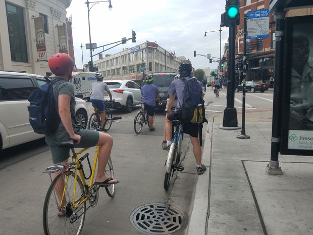
A groundbreaking bikeways project is starting up in Edgewater, which Active Trans hopes sets a precedent for all of Chicago’s neighborhoods.

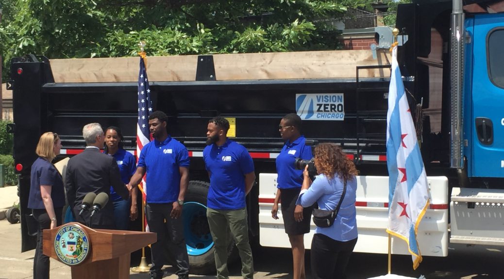
This past week the Chicago Department of Transportation (CDOT) and the office of Alderman Harry Osterman of the 48th ward hosted a community meeting to kick off the conversation around the pilot program to create a neighborhood bikeways network for Edgewater.

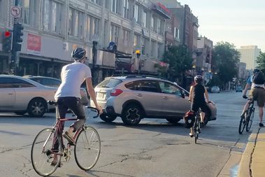
The goal of the project is to create a well-connected neighborhood bike network designed for people of all ages and abilities.

The project will focus on identifying new east/west routes, building upon existing north/south routes, creating connections to schools, crossing major arterial avenues of Broadway, Clark Street, and Ashland Avenue, and closing other gaps in the existing neighborhood network.

What really sets this project apart is that funding is already in place to build all the newly identified bike routes at once. According to CDOT, construction is slated to take place in 2019.

This initiative marks a big step forward towards achieving the goal Active Trans is pursuing in our Bikeways for All Campaign: a seamless, equitable, and low-stress bike network throughout all of Chicago.

By investing in complete networks of “low-stress” bikeways, such as protected bike lanes, neighborhood greenways and urban trails, we know more people will be encouraged to use bikes as everyday transportation.

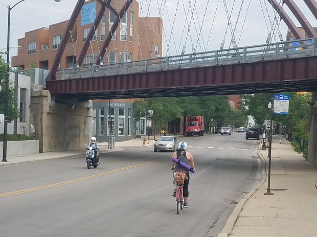
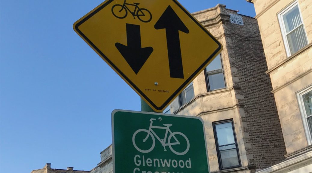
Examples of low-stress bikeways can already be found throughout Edgewater, including the new Glenwood Greenway and, of course, the Lakefront Trail. The task undertaken by this new project will be to fill in the gaps and stitch these individual pieces into a seamless whole.

Creating this seamless network will provide the neighborhood with countless health, economic, and environmental benefits. According to census data, up to six percent of Edgewater residents already commute by bike and twelve percent of households in the community are without a car, highlighting the immediate need for additional protected bike lanes and neighborhood greenways in the community.

In addition to benefiting the people already using bikes as transportation, low-stress bike networks are proven to encourage more people to get around on two wheels. This in turn increases physical activity, which helps prevent chronic diseases like diabetes. Getting more people biking also cuts down on greenhouse gas emissions and air pollution.

Better conditions for biking will also provide local businesses with a boost. That’s because research has shown that people who regularly bike and walk to commercial corridors spend more than people who drive.

It is hard to overstate the number of different benefits this project can bring Edgewater. For that reason, Active Trans would like to see this process replicated citywide. We hope this project can serve as an example to other wards looking to expand equitable access to multi-modal transportation.

So what happens now?

CDOT and Ald. Osterman’s office are looking for input on important destinations in the ward, routes that you use now, routes you want to use, barriers to biking and walking, opportunities for success, and programming ideas. If you have any comments or questions, please contact [email protected] or [email protected].

The project planning will move forward with an organized bike ride later in the summer, task force meetings in the summer and fall, and a second community meeting in the winter of 2017. After engineering coordination throughout 2018, construction is expected to begin in 2019.